You are interested in Geogames, but you do not know, where to start?
Just for the case you want to take a quick glance on the opportunities, Geogames provide, we compiled a short product information for your convenience.
You are interested in Geogames, but you do not know, where to start?
Just for the case you want to take a quick glance on the opportunities, Geogames provide, we compiled a short product information for your convenience.
Two Geogames events took place (rather space) in summer 2014 so far:
– Peter Kiefer (ETH Zürich) presented at the ifgi Summer School 2014 on Gamyfing Spatial Collaboration using our CityPoker Designer and staging a game.
– Barbara Feulner (Augsburg University) staged a Neocartographer event with school kids evaluating urban public spaces in Augsburg
Olga Yanenko, member of the Geogames team, gave a lightning talk in this year’s DevSummit taking place March 10-13 at the Palm Springs Convention Center.
Have a look at her prezi!
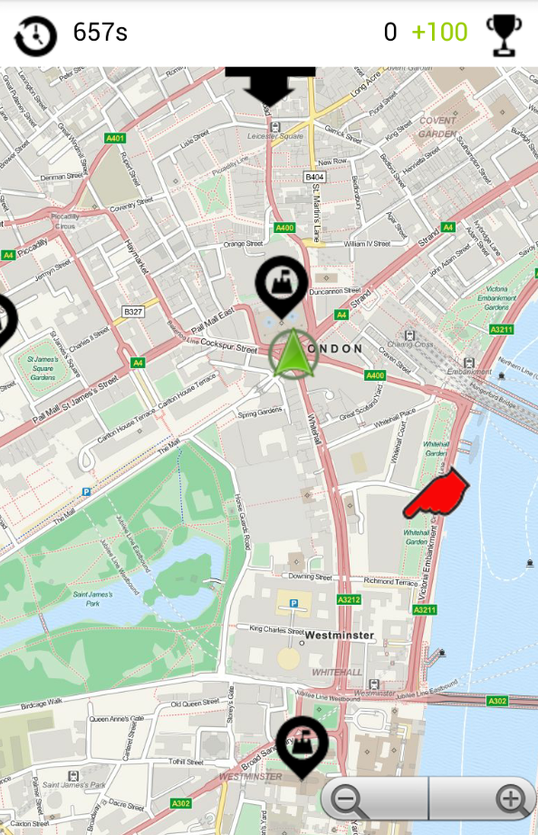
Where you think you are, is not where you might end up playing this game! Guesstimate is a casual game that uitilizes algorithms typically used for GPS positioning and provides you a random exploration experience of your city.
Knowing about your distance to predefined locations around you allows you to compute your current position. Of course, this task gets more difficult by  measurement errors. Guesstimate illustrates the impact of such errors by handing the job of delivering reliable distance measurements over to you: How far is it from your current position to e.g. Big Ben, Westminster Abbey or Tower Bridge? From your guesses, Guesstimate derives a geocoordinate where you would be, if your estimations were correct. Before the next round starts, you have to move to that place as a penalty – the better you guess, the less you walk…
Give it a try (just download the file on your Android device and tap once to install):
http://www.geogames-team.org/files/Guesstimate.apk
Got noone staging a game for you? Design your own gameboard with only a few taps on your mobile:
http://www.geogames-team.org/guesstimate/editor/
Thanks again to ESRI for making this possible.
As an outcome of the Geogames and Playful Geodesign project funded by ESRI, a new game is available. Equilibrium tells you a lesson about population dynamics.
Have a look at the demo video:
Interested? Drop us a line: geogames[at]uni-bamberg.de
As an additionel outcome of the Geogames and Playful Geodesign project funded by ESRI, a designer tool for the CityPoker Geogame ist now available online:
www.geogames-team.org/designer/
Just give it a try! A brief introduction to the game is provided within the editor. All you need to play is the possibility to send messages from one team to the other!
A more precise workflow of the tool and its use cases in classes on geography at school will be published until August 2014 in the in the most widely read journal for geography teachers in Germany, Praxis Geography.
Got you? Drop us a line: geogames[at]uni-bamberg.de